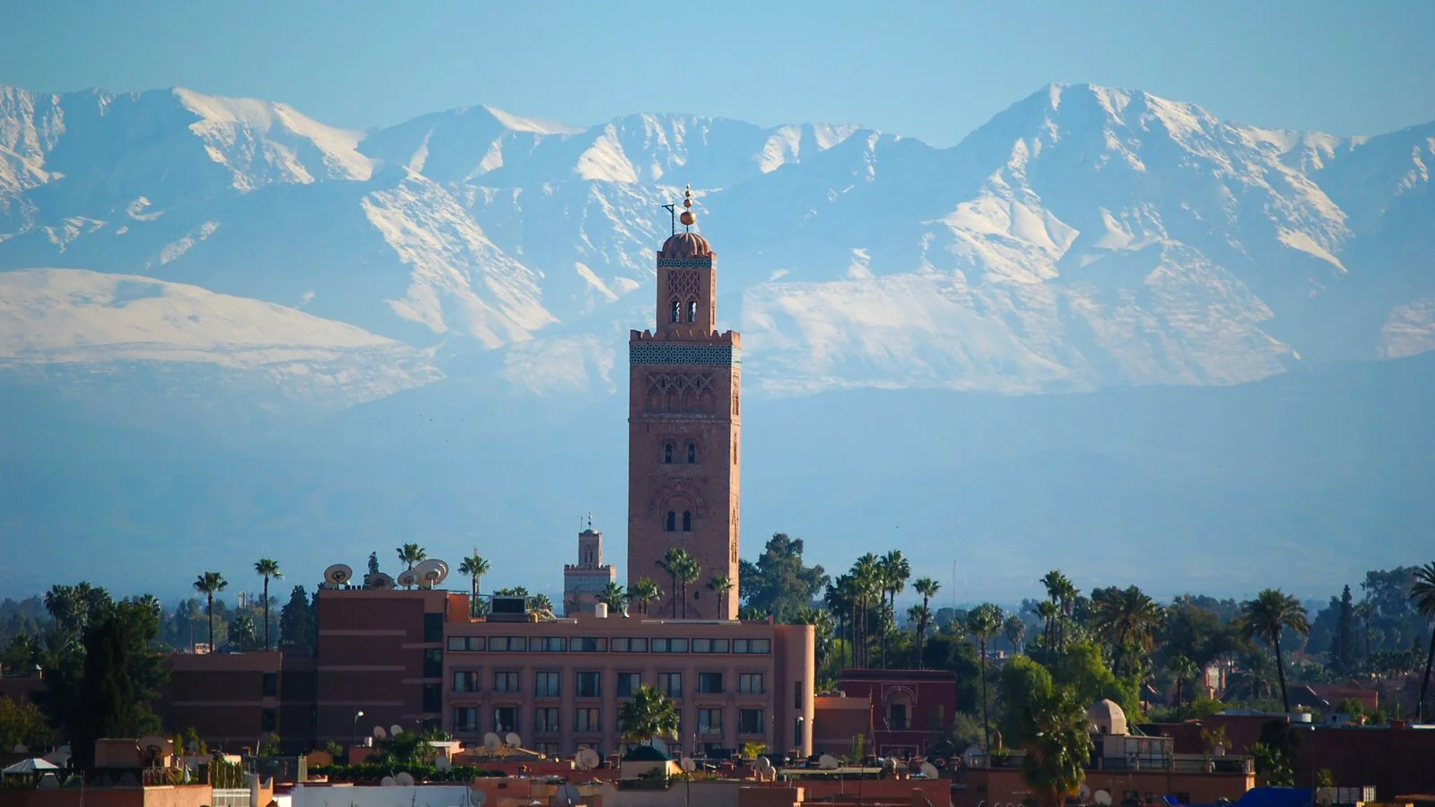
The High Atlas mountain range is the rugged backbone of Morocco and home to some of the most spectacular hiking in North Africa. Its crown jewel is Jebel Toubkal, whose 4,167‑m summit is not only the highest point in Morocco but also the tallest peak in the entire Atlas chain and the Arab world. Whether you’re a seasoned alpinist looking for a high‑altitude challenge or an adventurer seeking cultural immersion in remote Amazigh (Berber) villages, the Atlas offers routes that reward both legs and soul.
This guide is designed for 2026 visitors who want to plan an unforgettable trek. It covers logistics, route itineraries, cultural considerations, gear, acclimatisation and safety. It also explains why Morocco now requires trekkers to hire certified guides on Toubkal routes—a change that reinforces both safety and community benefit. With this information you’ll be well prepared to explore the red valleys, alpine lakes, snow‑capped summits and welcoming villages that define the High Atlas.
Understanding the High Atlas
Geography & Significance
Spanning roughly 750 km across central Morocco, the High Atlas is the loftiest of three Atlas subranges (the Middle and Anti‑Atlas being the other two). It runs east–west from the Atlantic coast near Agadir to the edge of the Sahara and forms a climatic barrier between the humid plains to the north and arid deserts to the south. High passes exceed 3,000 m and snow fields persist on the highest ridges well into summer. Jebel Toubkal’s 4,167‑m summit towers over this landscape, offering sweeping views that on clear days extend from the Sahara to the Atlantic.
For centuries, the Imazighen (Berber) people have inhabited these valleys. They tend terraced fields, shepherd livestock to high pastures and maintain a distinct language and culture. Trekking here is as much a cultural journey as a physical one—you’ll share tea with villagers, sleep in simple mountain gîtes or azibs (shepherd huts) and witness sustainable agriculture that has changed little in hundreds of years.
Why Trek in the High Atlas?
-
Varied routes for all levels: From gentle day hikes along the Ourika Valley’s waterfalls to technical winter ascents requiring ice axes, the Atlas offers choices for families, trekkers and climbers. For first‑time visitors the two‑day standard Toubkal summit route and the multi‑day Toubkal Circuit provide contrasting experiences—one is a quick up‑and‑down to the summit; the other loops around remote valleys and lakes before tackling the peak. Other treks like the M’Goun Traverse or Valley of the Roses reveal wild canyons, high plateaus and nomadic pastoral life.
-
Rich cultural interactions: The High Atlas remains primarily Amazigh. Trekking here supports local economies and preserves traditional lifestyles. Hiring a licensed local guide helps ensure your money stays in the community and that you gain insight into customs, agriculture and history.
-
Accessible from Marrakech: The hub for most treks is Imlil, a village about 65 km south of Marrakech. A taxi or van ride gets you there in around 90 minutes, making weekend expeditions viable.
How to Get to the Atlas Mountains
Reaching the High Atlas is straightforward once you’re in Morocco. Most international flights arrive in Marrakech or Casablanca. From Marrakech’s Menara Airport you can arrange private transfers, hire a taxi from the main square (Jemaa el‑Fna) or book transport through your trekking operator. The typical base village for Toubkal treks is Imlil (1,740 m). It has numerous guesthouses and equipment shops, and you can rent mules for luggage transport. For other treks such as the M’Goun or Roses Valley traverse you may start from villages like Tacheddirt, Amsouzert or Tabant.
Travel tip: Public grand taxis departing from Marrakech’s Bab er‑Rahba taxi stand can take you to Asni, the regional market town, where you then arrange another taxi to Imlil. For comfort and time‑saving, most trekkers prefer to pre‑book a transfer.
When to Go: Seasons & Weather
The High Atlas experiences distinct seasons, and choosing the right window is crucial for a safe and enjoyable trek.
Spring (April–June)
Spring is arguably the most beautiful season. Wildflowers carpet terraces, rivers are full from snowmelt and temperatures range from cool mornings to warm afternoons. April and May are considered ideal for climbing Toubkal because you avoid the extreme heat of midsummer and the harsh cold of winter. Note that lingering snow may remain on high passes, especially early in April.
Summer (July–August)
Summer brings longer daylight but also high temperatures. In Marrakech, daytime temperatures often exceed 40 °C; in the mountains they are about 10 °C cooler. Lower valleys can still be uncomfortably hot for walking, but high passes are snow‑free and conditions are stable. If you plan to attempt multi‑day treks like the Toubkal Circuit, aim for early June or late August when there are fewer crowds.
Autumn (September–October)
Many trekkers and tour operators prefer September and October. The tourist crowds of summer have diminished, temperatures drop to the mid‑20s °C and the weather is generally clear. There is little or no snow on the standard Toubkal route, and fruit harvests in Berber villages add colour and activity. Autumn is often considered the absolute best time for first‑time climbers.
Winter (November–March)
Winter transforms the High Atlas into an alpine landscape. Snow blankets paths above 3,000 m, and summit attempts require crampons, ice axes and possibly ropes. Temperatures can fall below –10 °C on Toubkal’s summit. Although the standard route remains non‑technical in summer, winter ascents become technical, and avalanche risk should not be underestimated. Guided winter tours operate from late November to April; experience in winter mountaineering is necessary and specialized equipment can often be rented in Imlil.
Logistics note: Some treks (e.g., M’Goun or Roses Valley) may be inaccessible in winter because high passes become impassable. Always check local conditions and consult with your guide before setting out.
Do You Need a Guide?
Mandatory Guide Requirement
Since December 2019 it has been law that anyone trekking on the route between Imlil and the summit of Jebel Toubkal must be accompanied by a certified local guide. The regulation was introduced after a tragic incident in 2018 and aims to enhance trekker safety and preserve the environment. Official checkpoints are located in villages such as Aroumd (Aremd); police or park officials will check your passport and your guide’s credentials. If you arrive without a certified guide you will be turned back.
The requirement applies year‑round and to all nationalities. Even experienced mountaineers must comply. Local guiding associations, like the Office of Mountain Guides of Imlil, train guides in navigation, first aid, altitude illness management and environmental ethics.
Why Hiring a Guide Makes Sense
Beyond legal compliance, there are compelling reasons to hire a guide:
-
Safety & Acclimatisation: Toubkal’s summit rises well into altitude sickness territory. At 4,167 m, the air is thin and acute mountain sickness (AMS) becomes a real risk. Certified guides can recognize early signs of AMS and adjust the pace or itinerary accordingly. They also understand the mountain’s micro‑climates and will know when weather or avalanche risk warrants retreat.
-
Navigation & Local Knowledge: The standard path is straightforward, but alternative routes and side trails branch off in many directions. A guide ensures you stay on track and introduces you to local villages, cultural sites and history.
-
Language & Cultural Bridge: Many villagers speak Amazigh and little English or French. Guides help with translation, facilitate interactions and prevent misunderstandings.
-
Community Support: Hiring locally keeps money in the region and supports the sustainable development of mountain communities.
Guide Costs & Booking
Guide fees vary by route, season and whether meals, mules and equipment rental are included. For the standard two‑day Toubkal ascent, expect to pay roughly €80–€120 per person when booking as a small group; solo travellers pay more. Multi‑day itineraries including the Toubkal Circuit or M’Goun Traverse are typically packaged with transport, meals, mules and camping gear. Make sure your operator explicitly states that their guides are certified and that they handle checkpoint formalities. Reputable operators include Ian Taylor Trekking, Talamrout Summit, Atlas Imlil and Morocco Desert Tour.
Picking Your Trek: Route Options
1. Standard Toubkal Summit (2 Days)
This is the quickest way to reach Morocco’s highest point. Day 1 begins with a hike from Imlil (1,740 m) through the village of Aroumd and past the shrine of Sidi Chamharouch. You gain about 1,460 m over 6–7 hours to reach the Toubkal Refuge (Mouflons Refuge) at 3,207 m. Dinner is served in the refuge and you sleep in dormitories or private rooms depending on your booking.
Day 2 starts predawn. Headlamps illuminate the scree slope as you ascend roughly 960 m to the summit, arriving in 3–4 hours. After soaking up panoramic views of the Anti‑Atlas, Sahara and High Atlas, descend to the refuge for breakfast and continue down to Imlil. This climb is feasible year‑round but becomes technical in winter (November–April). Because of the rapid ascent, it offers little time to acclimatise; trekkers prone to altitude sickness should consider longer itineraries.
2. Toubkal Circuit (6 Days)
For a deeper immersion, the Toubkal Circuit loops around the massif before summiting, visiting remote villages, high passes and alpine lakes. The itinerary below summarises the 6‑day version used by reputable operators like Talamrout Summit:
-
Day 1 – Marrakech → Imlil → Tacheddirt (2,300 m): After a 1½‑hour transfer from Marrakech, meet your guide and muleteers in Imlil. Hike through orchards and walnut groves, climb over Tizi n’Tamatert (2,300 m) and descend to the high village of Tacheddirt, one of Morocco’s highest settlements. Overnight in a simple guesthouse.
-
Day 2 – Tacheddirt → Tizi n’Likemt (3,550 m) → Azib Likemt: A long ascent leads over Tizi n’Likemt, one of the highest passes in the Atlas (3,550 m), with sweeping views. Descend to Azib Likemt, a seasonal shepherd camp, and camp overnight.
-
Day 3 – Azib Likemt → Tizi n’Ourai (3,120 m) → Amsouzert (1,740 m): Traverse a wild valley, climb to Tizi n’Ourai and descend into the lush Aourai valley. Stay in a village guesthouse in Amsouzert, one of the largest villages in the region.
-
Day 4 – Amsouzert → Ifni Lake (2,300 m): A shorter day leads through terraced fields to Ifni Lake, a turquoise lake set beneath towering peaks. Camp beside the lake; swimming is possible in summer.
-
Day 5 – Ifni Lake → Tizi n’Ouanoums (3,670 m) → Toubkal Refuge (3,207 m): The toughest day. A steep ascent to Tizi n’Ouanoums (3,670 m) brings you beneath Toubkal’s southern face. Descend zigzagging trails to the refuge and sleep in bunkrooms or tents.
-
Day 6 – Refuge → Toubkal Summit → Imlil → Marrakech: Begin around 4–5 am for the summit. After 3–4 hours reach Toubkal’s summit (4,167 m). Descend to the refuge, continue down to Imlil and transfer back to Marrakech.
This itinerary balances acclimatisation and cultural depth. You’ll cross passes over 3,500 m, camp by an alpine lake and still experience the summit. The best season is late April through October, when conditions are warm and passes are snow‑free.
3. Alternative Routes & Side Trips
-
M’Goun Massif: Located east of Toubkal, the M’Goun Traverse offers wilder landscapes, deep canyons and high plateaus. Hikers cross the Achabou Gorges and meet nomadic shepherds. Summiting Mount M’Goun (4,071 m) requires a moderate fitness level and is usually done over five to seven days.
-
Ourika Valley Foothills: For a gentle introduction, hike the trails around Setti Fatma. Green landscapes, waterfalls and traditional Amazigh villages make this a perfect day trip.
-
Valley of the Roses & Jebel Saghro: South of the High Atlas, multi‑day treks explore arid plateaus punctuated by kasbahs, fragrant rose fields and lunar landscapes. These trips often combine hiking with visits to oases and desert dunes.
Trek Difficulty & Fitness Requirements
The standard Toubkal ascent is non‑technical in summer but remains a demanding hike. Day 1 involves a 1,460‑m elevation gain to the refuge, and Day 2 adds another 960 m to the summit. The descent is long and tough on knees. The Toubkal Circuit and M’Goun treks require multiple days of 4–10 hours of walking with daily elevation gains of 600–1,200 m.
A good level of cardiovascular fitness and leg strength is essential. Train by hiking with a loaded backpack, stair climbing and cardio exercises. Breaking in your boots ahead of time prevents blisters and improves comfort. The mental challenge should not be underestimated: summit day on both routes starts in the dark and feels long. Adequate sleep, pacing and nutrition are crucial.
Acclimatisation & Altitude Safety
Understanding Altitude Sickness
Acute mountain sickness (AMS) occurs when you ascend too quickly to high elevations. Above roughly 2,500 m the risk of AMS increases because there is less oxygen per breath. Symptoms range from mild headaches and nausea to severe complications such as High Altitude Pulmonary Edema (HAPE) and High Altitude Cerebral Edema (HACE). Although serious cases are rare on Toubkal, proper acclimatisation and vigilance are vital.
Acclimatisation Strategies for Toubkal
-
Ascend Gradually: The Toubkal Circuit’s itinerary includes overnight stays at increasing elevations (2,300 m; 2,500 m; 1,740 m; 2,300 m; 3,207 m) which allow your body to adjust. The strategy of “climb high, sleep low” is key: you may cross passes above 3,500 m but sleep lower to aid adaptation.
-
Stay Hydrated & Eat Well: Drink at least 3 litres of water per day. Dehydration exacerbates AMS symptoms. Pack snacks like nuts, energy bars and dried fruit to maintain energy.
-
Listen to Your Body: Mild headaches, nausea or vivid dreams are common between 2,500 m and 3,800 m. If symptoms worsen despite rest, descend and inform your guide immediately. Never push through severe AMS; descent is the only effective treatment.
-
Consider Acclimatisation Hikes: Spend an extra day in Imlil or take a warm‑up hike to a lower pass before your trek. This extra day can help your body adapt and makes the main trek more enjoyable.
-
Medication: Some travellers use acetazolamide (Diamox) to aid acclimatisation, but consult your doctor before departure. Guides may require you to provide a doctor’s note if you’re using medication.
Insurance & Emergency Procedures
Although serious altitude emergencies are rare on Toubkal, you should carry travel insurance that covers trekking to 4,200 m and emergency evacuation. Certified guides are trained in first aid and altitude management. They will enforce a strict descent policy if you show significant AMS symptoms. Evacuation from Toubkal generally involves descending to Imlil on foot or by mule; helicopter rescue is rare and expensive.
Essential Gear & Packing List
The High Atlas environment can change rapidly—from scorching sun to hail and snow within hours. Packing appropriate gear ensures comfort and safety.
Clothing & Footwear
-
Layered system: Pack moisture‑wicking base layers, a fleece mid‑layer and an insulated down or synthetic jacket. A waterproof hardshell jacket with a hood is essential for wind and snow. In winter or on high passes, add a midweight softshell jacket and thermal layers.
-
Legwear: Bring hiking trousers, softshell pants, thermal leggings and waterproof over‑trousers. Shorts are acceptable in lower valleys during summer.
-
Head & Hands: You need a warm hat, sun hat, buff or neck gaiter, sunglasses (category 4) and gloves. Thin glove liners are ideal for warm days; thick waterproof gloves are crucial in winter.
-
Footwear: Well‑broken‑in trekking boots with ankle support are mandatory. Carry spare socks and consider lightweight camp shoes or sandals for evenings.
-
Winter equipment: Crampons, ice axe and helmet are required for winter climbs. Check with your operator about rental availability in Imlil.
Gear & Accessories
-
Backpack: A 30–40 L daypack for personal gear plus a duffel bag or dry bag for luggage carried by mules.
-
Trekking Poles: Collapsible poles reduce strain on knees during descents.
-
Sleeping Equipment: In winter, bring a 4‑season sleeping bag and optionally a camping pillow. Tents, mattresses and sleeping bags are typically provided on guided treks.
-
Hydration: Carry at least two water bottles or a hydration bladder. Water treatment tablets are recommended if you fill up from streams.
-
Headlamp: A headlamp with spare lithium batteries is essential for early starts and refuge movements.
-
First Aid & Personal Items: Pack blister plasters, a small first aid kit, personal medications and hygiene supplies.
-
Documents & Money: Carry a passport photocopy, insurance documents, cash for tips and small purchases and a credit card for emergencies.
-
Electronics: Mobile phone, camera and power bank. Power in refuges is rationed (typically switched on for a few hours in the evening) so don’t rely on charging frequently.
Food & Nutrition
Guided treks usually include meals prepared by a cook. Expect hearty tagines, couscous, soups, fresh bread and mint tea. Bring personal snacks—energy bars, nuts, dried fruit and chocolate—for summit day when extra calories make a difference. Avoid overeating heavy foods at altitude as digestion slows; small frequent snacks are better.
Accommodation: Refuges, Gîtes & Camping
Mountain Refuges
The Toubkal Refuge (also called Refuge Les Mouflons) sits at 3,207 m and serves as the base camp for the standard and circuit summit attempts. It has dormitory rooms, a few private rooms, communal dining areas and basic toilets and showers (hot water may require a fee). Electricity is limited to evening hours. Reservations are mandatory in peak season; guides usually handle bookings.
Gîtes (Guesthouses)
In villages like Tacheddirt and Amsouzert, simple guesthouses called gîtes offer beds, blankets, showers and home‑cooked meals. Staying in a gîte provides direct interaction with local families and insight into daily life.
Camping & Azibs
On multi‑day treks you may camp in tents supplied by your operator. Campsites often have views of valleys or lakes and provide a sense of solitude. In some remote grazing areas you may stay in azibs, simple stone huts used by shepherds. These are basic—expect no electricity or running water—but memorable.
Cultural Etiquette & Responsible Travel
Amazigh Hospitality
The High Atlas is predominantly Amazigh. Hospitality is deeply ingrained and guests are treated with generosity. It is customary to greet locals with “Salaam alaikum” and to accept offers of mint tea. When visiting homes or staying in gîtes, dress modestly and remove your shoes at the door. In small villages you may hear the Amazigh language, but many people also speak Moroccan Arabic; your guide will translate as needed.
Respecting the Environment
-
Leave No Trace: Pack out all rubbish, including tissue paper and food wrappers. Do not disturb wildlife or pick wildflowers. Use toilets where provided; otherwise, dig a small hole at least 60 m from water sources.
-
Support Local Economies: Purchase crafts or supplies directly from villagers rather than from resellers in the cities. Hiring a guide and muleteer, and tipping fairly, helps sustain communities.
-
Water & Energy Conservation: Water is scarce in many villages. Take short showers and turn off taps. Bring a power bank to reduce the need to charge devices at refuges.
-
Photography & Drones: Always ask permission before photographing people. Drones are regulated in Morocco; obtain permits if you plan to use one.
Sample 3‑Day High Atlas Itinerary for Beginners
If you have limited time, consider a shorter trek that still captures the essence of the Atlas and incorporates cultural experiences.
Day 1: Transfer from Marrakech to Imlil. Hike to Aroumd and continue up to Azib Tamsoult (2,250 m) via a scenic waterfall. Overnight in a gîte or camp.
Day 2: Trek over Tizi n’Mzik (2,489 m) and descend into the Azzaden Valley, passing walnut groves and traditional villages. Spend the night in Tinzert or Ait Aissa.
Day 3: Continue down the valley, visit local cooperatives producing argan oil or carpets, and return to Imlil for transfer back to Marrakech. This itinerary avoids extreme elevation yet introduces you to Amazigh culture and mountain life.
Frequently Asked Questions
Is a permit required to climb Toubkal?
There is no separate trekking permit, but from December 2019 onwards a certified local guide is mandatory on the Toubkal routes. Checkpoints at Aroumd enforce this rule.
How fit do I need to be?
Moderate to high fitness is required. You should be comfortable walking 6–10 hours per day with significant elevation gain. The more time you spend training (hiking with a loaded pack, cardio workouts, strength training), the more enjoyable your trek will be.
Can I rent equipment?
Yes. In Imlil and Marrakech you can rent crampons, ice axes, trekking poles, sleeping bags and even full winter clothing. Confirm availability with your operator ahead of time.
What about mobile coverage and internet?
Mobile coverage in the High Atlas is patchy. Some villages have 3G; refuges may offer paid Wi‑Fi for short periods. Do not rely on internet access. Inform family/friends of your itinerary before you depart.
What wildlife might I see?
The High Atlas hosts species adapted to rugged terrain, including Barbary sheep, golden eagles, bearded vultures and feral goats. On remote paths you may see nomadic shepherds with flocks of sheep and goats. Always observe wildlife from a distance.
Building Topical Authority: Related Guides on Outdoors Atlas
To deepen your research and interconnect your knowledge, explore these related pages on Outdoor Atlas:
- Morocco Destination Overview – A country guide covering major regions, culture and travel tips.
- Activities: Hiking – Additional hiking resources covering routes across Morocco, Spain and Portugal.
- Morocco Hiking Collection – Curated lists of hikes and camping spots across the High Atlas and other ranges.
- Camping in Morocco – For those who want to combine treks with nights under the stars.
Conclusion
Trekking the Atlas Mountains is a powerful experience—physical, cultural and spiritual. Whether you choose a quick two‑day sprint to Toubkal’s summit or a week‑long circuit weaving through valleys and passes, you’ll encounter a landscape of deep red earth, emerald fields, snow‑capped peaks and genuinely hospitable communities. With careful planning, respectful behaviour and adherence to safety protocols like hiring certified guides, your 2026 Atlas expedition will leave lasting memories and a profound appreciation for Morocco’s mountainous heart.