Ponta de São Lourenço
Caniçal, Madeira
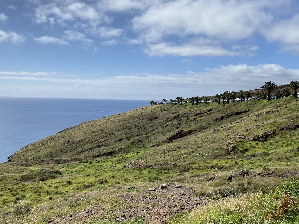
Ponta de São Lourenço is the stark, windswept eastern peninsula of Madeira — a world apart from the lush, green laurel forests that define the interior. The trail runs the full length of the headland across a landscape of sculpted volcanic tuff in shades of rust, ochre, charcoal, and green, with the deep blue Atlantic pounding both sides. It is the driest and most exposed corner of the island, where a unique microclimate supports endemic succulents and hardy shrubs that cling to the parsed rock.
The out-and-back route follows a well-defined path that rises and falls over the peninsula's ridges, each crest revealing a more dramatic composition of sea stacks, natural arches, and turquoise coves far below. At the very tip stands the Casa do Sardinha, a small shelter marking the end of the land — a threshold where only sea and sky remain. The return leg offers an entirely different perspective, with the sun shifting the colours of the rock and the shadows lengthening across the eroded badlands.
This is one of Madeira's most spectacular coastal hikes, ideal for photographers, geology enthusiasts, and anyone wanting to experience the island's wild, volcanic personality. The exposed trail can be very windy — bring a windproof layer and sun protection even on cooler days.
Highlights
- Spectacular peninsula trail on Madeira's easternmost tip
- Barren volcanic landscapes contrasting with deep blue Atlantic
- Unique endemic flora adapted to the exposed, arid microclimate
- Panoramic views back toward Madeira's mountain spine
- Colourful rock formations — red, ochre, black and green volcanic tuff
- Frequent sightings of seabirds and migrating whales offshore
Features
More hiking in Portugal
7 Valleys Hike
The 7 Valleys Hike is the Algarve's quintessential coastal walking exper…
Barragem do Rio da Mula
Barragem do Rio da Mula is a small reservoir tucked into the forested hi…
Boardwalk
The Ria Formosa Boardwalk is a beautifully constructed wooden walkway th…