Toubkal National Park
High Atlas, Marrakech
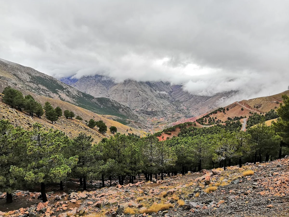
Toubkal National Park is Morocco's premier hiking destination, home to Jebel Toubkal (4,167 m), the highest peak in North Africa. Explore alpine trails, Berber villages, and dramatic glacial valleys in the heart of the High Atlas. Centred on Jebel Toubkal, the highest summit in North Africa at 4,167 metres, the park encompasses a rugged alpine landscape of soaring granite ridges, U-shaped glacial valleys, and deep river gorges. The park's trails range from gentle valley-floor walks among walnut groves and Berber hamlets to strenuous high-altitude ridge traverses and the iconic Toubkal summit ascent — a two-day climb that draws thousands of trekkers annually.
The trail network is extensive and well-documented, with the village of Imlil (1,740 m) serving as the main gateway. From Imlil, paths radiate in all directions: south towards the Toubkal Refuge (3,207 m) and the summit; east into the Aït Mizane Valley; west towards the Tizi n'Test pass; and north down the Ourika Valley towards Marrakech. Along the way, hikers encounter dramatic terrain — sheer cliff walls, boulder-strewn cirques, mountain lakes such as Lac d'Ifni, and high pastures (agoudal) where transhumant shepherds bring their flocks in summer. The park is also home to Barbary macaques, wild boar, golden eagles and, very rarely, the elusive Barbary leopard.
The best time to visit is from April to October, with June and September offering the most reliable weather for summit attempts. The Toubkal Refuge and several village gîtes provide basic but comfortable accommodation. Winter (December–March) brings heavy snows that transform the park into a mountaineering destination requiring ice axes, crampons and experienced guides. Whether you are ticking off a continent-high summit or simply enjoying a day walk through one of the valley gorges, Toubkal National Park delivers an unforgettable mountain experience in a landscape of immense scale and beauty.
Highlights
- Home to Jebel Toubkal (4,167 m), the highest peak in North Africa
- Dramatic alpine scenery with rugged cliffs, deep gorges and mountain lakes
- Extensive trail network crisscrossing the High Atlas core zone
- Rich Berber culture in valley villages like Imlil, Aroumd and Oukaimeden
- Unique high-altitude flora including Atlas cedar, holm oak and endemic species
- Spring-fed river valleys with cascading waterfalls and natural swimming pools
Features
More hiking in Morocco
Ammeln Valley
The Ammeln Valley (Vallée d'Ammeln) is a hidden gem in Morocco's Anti-At…
Berbere Hiking
Berbere Hiking operates in the coastal and pre-mountain terrain around A…
Cascades Ourika
Cascades Ourika is the most accessible and popular hiking destination in…