Monkey Fingers (Pattes Des Singes)
Boumalne Dades, Dades Valley
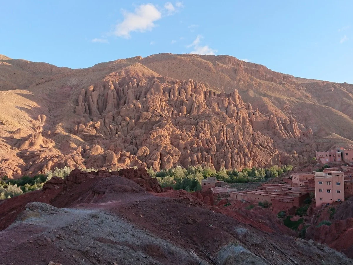
The Monkey Fingers — known locally as Pattes des Singes — are one of the Dades Valley's most photographed natural wonders. This cluster of slender, elongated rock spires rises abruptly from the valley floor, their shapes weathered by centuries of wind and flash flooding into columns that resemble a giant hand clawing up through the earth. The formations are composed of the same iron-rich sandstone that colours the entire Dades Gorge, but here erosion has carved them into isolated pinnacles, each one balanced on a narrow base.
The trail is short and undemanding, following a well-marked path from a small parking area through dry scrub and low tamarisk bushes. In under a kilometre you're among the formations, able to walk between the fingers and inspect the horizontal striations that tell the story of ancient seabeds, tectonic uplift, and the slow work of water. Late afternoon light paints the sandstone in deep oranges and crimsons, making this a favourite spot for photographers and landscape painters.
Despite its popularity, the site rarely feels crowded. Most visitors stop for fifteen minutes to take photos before moving on, leaving the trail quiet for those who want to sit and absorb the geology. Combine a morning at Monkey Fingers with a longer hike deeper into the Dades Gorge for a full day of exploration. There are no facilities at the site itself, so bring water and snacks — the nearest café is back in Boumalne Dades, ten minutes by car.
Highlights
- Iconic finger-like rock formations sculpted by wind and water over millennia
- Short, accessible trail suitable for all fitness levels and families
- Spectacular photo opportunities at sunrise and sunset when the rocks glow red
- Proximity to the main Dades Gorge road, easy to combine with canyon hikes
- Interpretive signs explaining the geological history of the formation
- Peaceful setting with views of the High Atlas peaks beyond the valley
Features
More hiking in Morocco
Ammeln Valley
The Ammeln Valley (Vallée d'Ammeln) is a hidden gem in Morocco's Anti-At…
Berbere Hiking
Berbere Hiking operates in the coastal and pre-mountain terrain around A…
Cascades Ourika
Cascades Ourika is the most accessible and popular hiking destination in…