Hiking Trail
Tafargoust
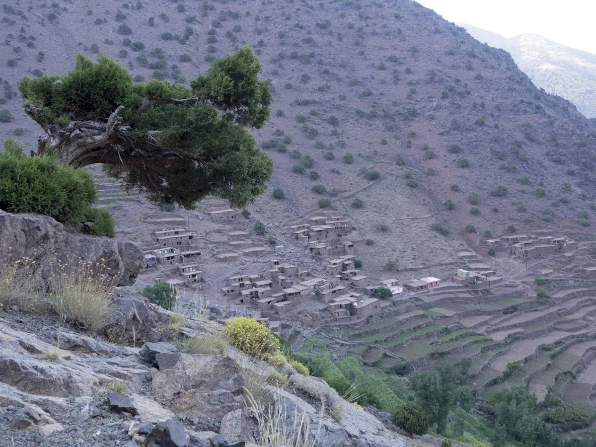
The Hiking Trail near Tafargoust cuts through a little-visited corner of Morocco's western High Atlas, offering walkers a genuine taste of rural mountain life without the crowds of the Toubkal corridor. Tafargoust is a small agricultural settlement on the southern flanks of the range, and the trail network here links scattered Berber farmsteads, olive terraces and patches of remnant juniper woodland. The landscape is characterised by rolling hills rather than towering peaks, giving a gentler hiking experience with far-reaching views across the N'Fis River valley.
The main trail follows ancient shepherd paths and mule tracks that connect the douars (hamlets) of the Tafargoust commune. It rises gradually through argan and juniper woodland before opening onto a plateau with panoramic vistas — on clear days the snowy summit of Toubkal is visible to the east. The terrain is a mix of packed earth, rocky sections and seasonal stream crossings, with wild thyme, lavender and broom bushes scenting the air in spring. Birdwatchers will note the presence of Barbary partridge, blue rock thrush and, occasionally, Bonelli's eagle overhead.
The best hiking months are spring (March–May) and autumn (September–November), when temperatures are moderate and the landscape is at its greenest. Tafargoust is accessible from Marrakech via the R203 road, a drive of about 1.5 hours. There is limited tourist infrastructure in the immediate area — this is part of its charm — so hikers should carry ample water, food and navigation aids. Local Berber families may offer mint tea and guidance, embodying the warm hospitality that defines the rural High Atlas experience.
Highlights
- Scenic trail through the rural countryside near Tafargoust in the western High Atlas
- Argan and juniper woodlands with diverse birdlife
- Views across the N'Fis River valley towards the Toubkal massif
- Berber farmsteads and olive terraces en route
- Quiet, off-the-beaten-path hiking away from tourist crowds
- Seasonal wildflowers and clear mountain streams
Features
More hiking in Morocco
Ammeln Valley
The Ammeln Valley (Vallée d'Ammeln) is a hidden gem in Morocco's Anti-At…
Berbere Hiking
Berbere Hiking operates in the coastal and pre-mountain terrain around A…
Cascades Ourika
Cascades Ourika is the most accessible and popular hiking destination in…