Explore Morocco Paths
Imlil, High Atlas
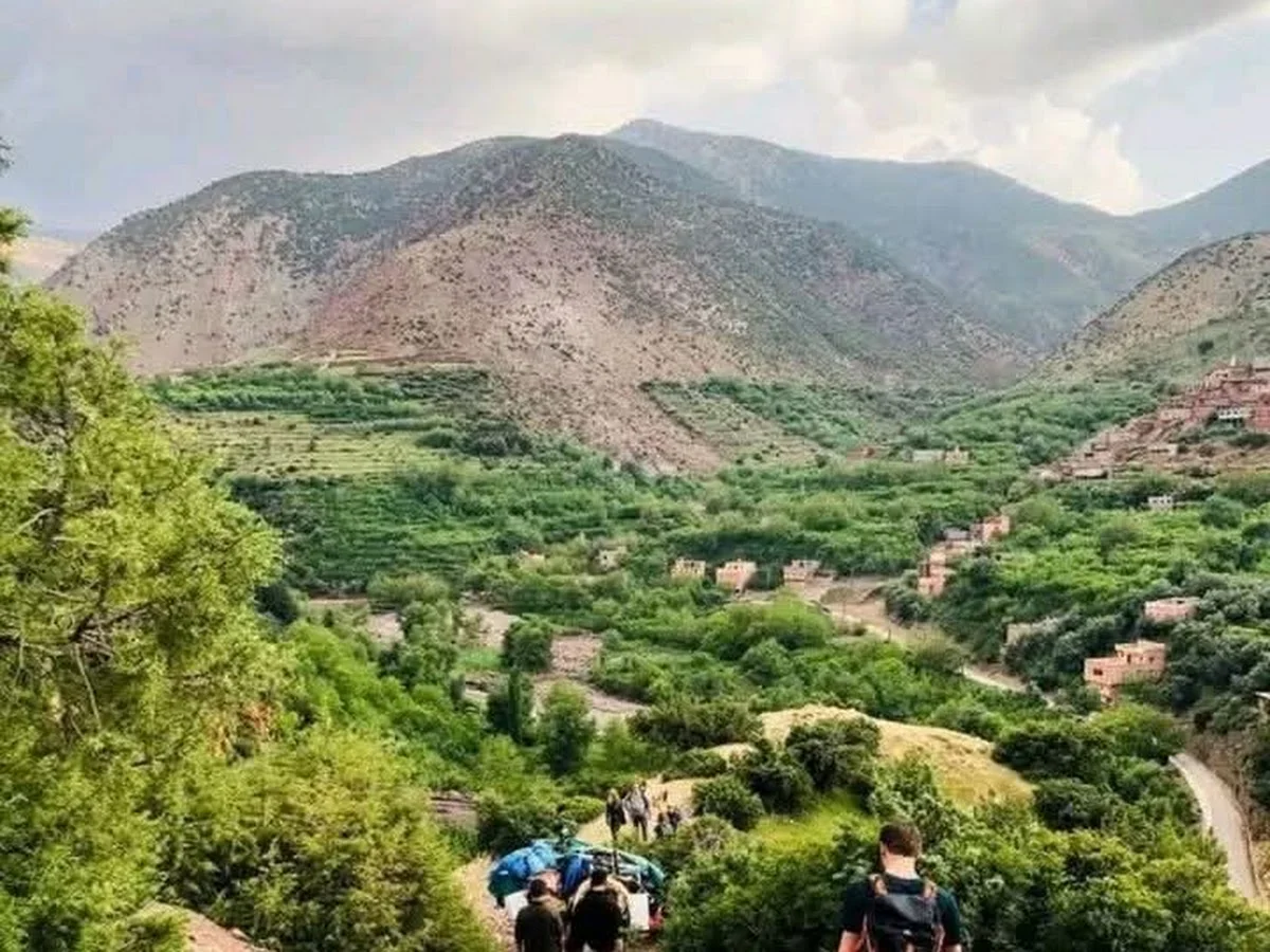
Explore Morocco Paths refers to the extensive network of hiking trails that radiates outward from Imlil, the de facto capital of High Atlas trekking. Imlil sits at a natural crossroads where several valley systems converge, and over centuries the local Amazigh communities have woven a dense web of footpaths connecting their villages, pastures, and mountain passes (tizi). These paths have been used by travellers and traders for generations, and today they form the backbone of the region's trekking infrastructure.
The trails range from gentle walks along the valley floor past walnut groves and irrigation channels to steep ascents up to the Toubkal Refuge (3,207 m) and onward to the summit of North Africa's highest peak. Intermediate options include the trek to the Tizi n'Tamatert pass (2,279 m), which offers sweeping views of the Aït Mizane valley and the distant M'Goun massif, or the walk to the shrine of Sidi Chamharouch, a place of pilgrimage set in a dramatic rocky amphitheatre. Each path has its own character, and the network allows for infinite variation — a single day out, a two-day circuit, or a week-long transect across the High Atlas.
For independent hikers, the trails are generally well-worn and easy to follow, though a map or GPS track is advisable beyond the immediate Imlil area. Waymarking (cairns and painted dots) exists on the main routes but is inconsistent on the lesser-used paths. Local guides are available for hire at the Imlil trailhead and offer invaluable insight into the landscape, the people, and the history of these mountains. Imlil itself has a good selection of gîtes, shops, and equipment rental, making it the ideal base for launching any High Atlas adventure.
Highlights
- Network of well-established hiking paths radiating from Imlil village
- Routes suitable for independent hikers and guided groups alike
- Connecting trails linking Imlil to Toubkal, the Aït Mizane valley, and beyond
- Accessible starting point with accommodation, supplies, and guide services
- Varied terrain from valley-floor footpaths to high-altitude passes
- Authentic village encounters in the scattered Berber communities along the way
Features
More hiking in Morocco
Ammeln Valley
The Ammeln Valley (Vallée d'Ammeln) is a hidden gem in Morocco's Anti-At…
Berbere Hiking
Berbere Hiking operates in the coastal and pre-mountain terrain around A…
Cascades Ourika
Cascades Ourika is the most accessible and popular hiking destination in…